hidden
|
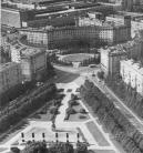
Admiralteyskaya Side
ADMIRALTEYSKAYA SIDE, a historical name of the central part of St. Petersburg bound on the north by the Neva river and on the south by the Moika River. Formed in the early 18th century when the General Admiralty
|
|
|
|
|
hidden
|
Alexandrovskoe, region
ALEXANDROVSKOE, an area to the south-east of St. Petersburg, confined by Zaporozhskaya Street, Moskovskaya Line of Oktyabrskaya Railway, Alexandrovskoy Fermy Avenue, Novo-Alexandrovskaya Street and the Neva River
|
|
|
|
|
hidden
|
Alexandrovsky Parade Ground
ALEXANDROVSKY PARADE GROUND, the historical name of the territory in the south-west of the city center, around the Alexander Nevsky Lavra, north of Obvodnoy Canal and west of the Monastyrka River
|
|
|
|
|
hidden
|
Aviagorodok
AVIAGORODOK, an area in St. Petersburg's Moskovsky District, in the southern part of the city, west of Pulkovskoe Highway and near the Airport Railway Station. In 1931-41, it was Leningrad's main airport and included a living bloc for its staff
|
|
|
|
|
hidden
|
Avtovo
AVTOVO, an area in the southwest part of St. Petersburg, bordered by the Krasnenkaya River on the south and Komsomolskaya Square on the north. The name origin traces back to the Finnish village of Autovo (Auktovo)
|
|
|
|
|
hidden
|
Belevskoe Field
BELEVSKOE FIELD, an area to the south-east of St. Petersburg, confined with Alexandrovskoy Fermy Avenue, Sedova Street, Krasnykh Zor Boulevard and Moskovskaya Line of Oktyabrskaya Railway
|
|
|
|
|
hidden
|
Bolshaya Okhta, locality
BOLSHAYA OKHTA, a locality in the east of St. Petersburg, on the right bank of the Neva River, surrounded by the Okhta River, Energetikov Avenue and Revolyutsii Freeway
|
|
|
|
|
hidden
|
Chekushi
CHEKUSHI is an area located in the south-western part of Vasilievsky Island. Its name is known from the first part of the 18th century and is related to "chekushi" or "tokmochi"
|
|
|
|
|
hidden
|
City Sides (entry)
CITY SIDES (St. Petersburg City Sides), a general name of St. Petersburg historical districts, which emerged in the early 18th century. Determined by St. Petersburg's location on different banks (sides) of the Neva River
|
|
|
|
|
hidden
|
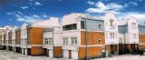
Dachnoe
DACHNOE, an area in the south-west part of St. Petersburg, between Krasnenkaya River, Baltiiskaya Railway Line, Stachek Avenue and Alexandrino Forest Park. In the north, it borders Avtovo, in the south-west Ulyanka
|
|
|
|
|
hidden
|
Five Corners
FIVE CORNERS, a traditional informal name of the crossroads, formed by Zagorodny Avenue, Lomonosova Street (former Chernyshev Lane), Rubinstein Street (former Troitskaya Street) and Razyezzhaya Street. Appeared in the 1760s
|
|
|
|
|
hidden
|
Gorelovo, locality
GORELOVO, an area in the south-west of St. Petersburg, along Tallinskoe Freeway, to the north of Krasnoe Selo. It was named after a village of the same name. In the 19th - early 20th centuries
|
|
|
|
|
hidden
|
Grazhdanka
GRAZHDANKA, an area to the north of St. Petersburg. Named after a German settlement (sometimes, referred to as Gorozhanka) that was formed in the second half of the 18th century on Staraya Murinskaya Road (the present-day site of Favorskogo Street)
|
|
|
|
|
hidden
|
Harbour
HARBOUR is an area in the western part of Vasilievsky Island. Soon after the foundation of St. Petersburg, earthworks and the artillery battery were put up here to protect the entrance to the Bolshaya Neva River
|
|
|
|
|
hidden
|
Ingermanland
INGERMANLAND (Swedish variant, Ingermanland; Russian variant, Izhorskaya Zemlya, or Ingria), a historic-cultural region including the Neva region, the Gulf of Finland shore, and the southwestern of Ladoga Region
|
|
|
|
|
hidden
|
Kamenka, area
KAMENKA (Bolshaya Kamenka, until 1930 - Koloniya Kamenka "Kamenka Colony"), the former village in the north-west of St. Petersburg, north of Yuntolovskaya Forest Estate, and north-west of the region of large-scale residential building of Dolgoe Lake
|
|
|
|
|
hidden
|
Kantsevskaya Side
KANTSEVSKAYA Side, the name of the territory on the right bank of the Okhta River, at the confluence of the Okhta and the Neva, that was current in the 18th century. It comes from the Russian name of the former Swedish fortress Nyenschantz - Kantsi
|
|
|
|
|
hidden
|
Kolomna
KOLOMNA, a historical district in the west part of St. Petersburg, between the Bolshaya Neva, Moika, Fontanka and Kryukov Canal. The name appeared in the early 18th century, most likely, on account of working people from the town of Kolomna
|
|
|
|
|
hidden
|
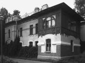
Kolomyagi
KOLOMYAGI, an area to the north-west of St. Petersburg, north of the Komendantsky Aerodrome and south-west of Ozerki; in the west it is adjacent large-scale residential development of Ozero Dolgoe
|
|
|
|
|
hidden
|
Koltovskie, locality
KOLTOVSKIE, historical name of a region in the western part of Petrogradsky Island between Pionerskaya Street (former Bolshaya Koltovskaya Street), Bolshaya Zelenina Street
|
|
|
|
|
hidden
|
Komendantsky Aerodrome
KOMENDANTSKY AERODROME, an area in the north-west of St. Petersburg, between Kolomyazhsky Avenue, Parashyutnaya Street, Sizova Street and Chernaya Rechka river
|
|
|
|
|
hidden
|
Krasnye Zori
KRASNYE ZORI, a locality in the East of Petrodvortsovy District between Strelna and New Peterhof, also a railway platform along the Baltiyskaya Railway Line. The name derives from Krasnye Zori labour settlement school
|
|
|
|
|
hidden
|
Kushelevka, area
KUSHELEVKA, an area in Vyborgskaya Side, between Karbysheva Street, Nepokorennykh Avenue, Bogoslovskoe Cemetery and Polyustrovsky Avenue. In 1781, Empress Catherine II granted 746 desyatin of land "in Vyborgskaya Side between Pargolova Dacha
|
|
|
|
|
hidden
|
Lakhta, locality
LAKHTA, a landmark northwest of Saint Petersburg, on the northern coast of the Gulf of Finland, in the vicinity of a cognominal railway station and Lake Lakhta; neighbours Olgino on the West, and Staraya Derevnya on the East
|
|
|
|
|
hidden
|
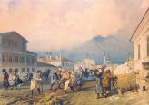
Landskrona
LANDSKRONA (from the Swedish "Landskron", meaning the crown of land), a Swedish fortress, built in 1300 at the confluence of the Okhta River and the Neva River
|
|
|
|
|
hidden
|
Lesnoy
LESNOY, a historical district in the north of St. Petersburg, between Engelsa Avenue to the west, Manchesterskaya Street to the north, Thoreza Avenue and Karbysheva Street to the east and Novorossiiskaya Street to the south
|
|
|
|
|
hidden
|
Levashovskaya Pustosh
LEVASHOVSKAYA PUSTOSH, a tract of land in the vicinity of the Levashovo Railway Station (135 Gorskoe Highway), one of the cemeteries for political victims born in Leningrad
|
|
|
|
|
hidden
|
Malaya Okhta, locality
MALAYA OKHTA, a locality in the eastern part of St. Petersburg, situated on the left bank of the Neva River, above the mouth of the Okhta River. It borders on Soedinitelnaya Railway Line in the north and the Okkervil River in the north-east
|
|
|
|
|
hidden
|
Malinovka
MALINOVKA, formerly a village, located in the northeast of St. Petersburg; known from the late 18th century. It stretched at the place where two rivers of the same name converge (sometimes called Narvin Brook) and the Okhta River (at the
|
|
|
|
|
hidden
|
Martynovka
MARTYNOVKA, a locality in the northwest of St. Petersburg northwards from Kolomyagi. In the late 19th to early 20th centuries there was the summer cottage settlement of Grafskaya intersected by a narrow-track railway connecting Novaya Derevnya and
|
|
|
|
|