Authors
/
hidden
|
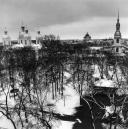
Ligovsky Canal
LIGOVSKY CANAL was constructed to supply drinking water to St. Petersburg under the project of Grigory Skornyakov-Pisarev in 1718-21. Originally, it was 23 km long, 2-4 meters bottom-wide and 1-2 meters deep
|
|
|
|
|
hidden
|
Lomonosovskaya Harbour (the city of Lomonosov)
LOMONOSOVSKAYA HARBOUR is a natural gulf located on the southern shore of the Gulf of Finland in the northern part of the city of Lomonosov (hence, the name) at the head of the Karasta River. It cuts inland for almost 0
|
|
|
|
|
hidden
|
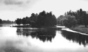
Lubya, river
LUBYA, a river in the north-east of St. Petersburg, in the area of Rzhevka and Porokhovye. The river is also known as Luppa (a distorted version of Izhora word lupyu which means a river littered with timber)
|
|
|
|
|
hidden
|
Malaya Neva
MALAYA NEVA, the second largest (after Bolshaya Neva) branch of the Neva river delta. The Malaya Neva separates from the Neva near the Spit of Vasilievsky Island and flows into the Neva Bay between Dekabristov Island and Petrovsky Island
|
|
|
|
|
hidden
|
Malaya Nevka
MALAYA NEVKA, a branch of the Neva river delta, which splits off from the Bolshaya Nevka near the Spit of Kamenny Island. The river flows into the Neva Bay between Krestovsky Island and Petrovsky Island, converging with the Malaya Neva
|
|
|
|
|
hidden
|
"Marquis's Puddle"
"MARQUIS'S PUDDLE", an ironic local name of the eastern part of the Gulf of Finland between the Neva head and Kotlin Island. The name was coined by Baltic fleet officers in the beginning of the 19th century
|
|
|
|
|
hidden
|
Maslobuyansky Canal
MASLOBUYANSKY CANAL (the Maslyany (Oil) Canal, the Maslyany Buyan Ditch) was constructed in the southeast Vasilievsky Island in the middle of the 18th century. It was named after the now non-existent Maslyany Buyan
|
|
|
|
|
hidden
|
Matisov Canal
MATISOV CANAL is located in the southwest of St. Petersburg westwards from Yuzhno-Primorsky Park. The canal was excavated in the second half of the 20th century in the left bank lows of Duderhof Canal amidst swampy surrounding of Neva Lowland
|
|
|
|
|
hidden
|
Monastyrka, river
MONASTYRKA, a river in the south-east of the central part of St. Petersburg, running from Obvodny Canal to the Neva River. The name originates from the monastery located on its banks, Alexander Nevsky Lavra
|
|
|
|
|
hidden
|
Morskie Dubki, Park (Lisy Nos)
MORSKIE DUBKI is a park at the West end of the village Lisy Nos. It stretches in a strip near the shore of the Gulf of Finland. Its length is approximately 500 metres and its width ranges from 100 to 250 metres
|
|
|
|
|
hidden
|
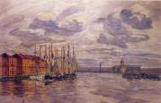
Morskoy Canal
MORSKOY CANAL (the Naval Canal) was constructed along shallow waters of Neva Bay between Gutuyevsky and Kanonersky Islands in 1874-85. The Canal has materially changed the islands' shape
|
|
|
|
|
hidden
|
Murinsky Stream
MURINSKY STREAM, a water course in the north of St. Petersburg and a tributary to the Okhta River. The name comes from the village of Murino. The stream heads from Sosnovka Park
|
|
|
|
|
hidden
|
Murzinka, river
MURZINKA, a locality enclosed by Zaporozhskaya Street, the Neva River, the Murzinka River and the railway line linking Obukhovo and Rybatskoe. The name originates from the grange (later to become a village) of Murzinka, which belonged to A.I
|
|
|
|
|
hidden
|
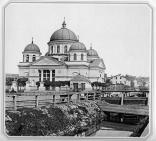
Natural sights
NATURAL SIGHTS, natural formations, typical of certain processes and phenomena and as a rule specific within surrounding scenery; they can be divided into geological, geomorphological, botanic, hydrological sights etc
|
|
|
|
|
hidden
|
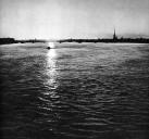
Neva Bay
NEVA BAY is a shallow eastern end of the Gulf of Finland located between the Neva River and Kotlin Island (traditionally referred by citizens of St. Petersburg and sailors as "Marquis's Puddle")
|
|
|
|
|
hidden
|
Neva, river
NEVA, a river in the north-west of Russia, around which the city of St. Petersburg is located at the river mouth. The river issues from the Shlisselburg Bay of Lake Ladoga and enters the Neva Bay of the Gulf of Finland
|
|
|
|
|
hidden
|
Nikolsky Garden
NIKOLSKY GARDEN is located in the centre of St. Petersburg between Kryukov Canal Embankment, Griboedova Canal Embankment, Rimsky-Korsakov Avenue and Nikolsky Lane. The total area of the garden is 1.7 hectares. It was laid out in the 18th century. St
|
|
|
|
|
hidden
|
Novo-Orlovsky Forest Park
NOVO-ORLOVSKY FOREST PARK is located in the north of St. Petersburg in Kolomyagi, west from Ozerki. The total area of the park is 144 hectares. The park was laid out in 1955 on the area of natural forests. The Kamenka River runs through it
|
|
|
|
|
hidden
|
Okhta, river
OKHTA (from Finnish word meaning "bear; pertaining to a bear"), a river in the east of St. Petersburg, the largest tributary to the Neva River within the limits of the city
|
|
|
|
|
hidden
|
Okhtinsky Razliv
OKHTINSKY RAZLIV is an artificial reservoir constructed after the building of the dike at the Okhta River in the area of the Powder Factory in the 19th century. Its lake-shaped bed width is about 5 km long, 250 meters wide and up to 4 meters deep
|
|
|
|
|
hidden
|
Okkervil, river
OKKERVIL, a river in the north-east of St. Petersburg, a left tributary to the Okhta River, which flows into the latter 1.8 kilometres above the mouth of the Okhta
|
|
|
|
|
hidden
|
Olympia, the Garden
OLYMPIA, is a garden in the centre of St. Petersburg, on Moskovsky Avenue, between Klinsky Avenue, Malodetskoselsky Avenue and Bataisky Lane. The total area of Olimpiya is 2.7 hectares. It was laid out on the location of Klinsky Market in 1946-47
|
|
|
|
|
hidden
|
Orlovsky Park (Strelna)
ORLOVSKY PARK is a landscape park following English traditions. It was laid out in the first half of the 19th century (architect P. S. Sadovnikov) in the estate of Count A. F. Orlov in Strelna
|
|
|
|
|
hidden
|
Pargolovo Hills
PARGOLOVO HILLS, a natural prominence in the south of St. Petersburg. It received its name from a Finish village of Parkola (later called Pargolovo) that was once situated in the surroundings
|
|
|
|
|
hidden
|
Petrovsky Park
PETROVSKY PARK is located on Petrovsky Island, along the left bank of the Zhdanovka River. It is surrounded with Petrovsky Avenue. Landscape planning of the present-day park (the total area is approximately 6
|
|
|
|
|
hidden
|
Petrovsky Pond
PETROVSKY POND is located in the south-east of Petrovsky Island in Petrovsky Park. It is a recreational zone, 350 meters long and 150 meters wide.
Y. P. Seliverstov
|
|
|
|
|
hidden
|
Pionersky Park
PIONERSKY PARK is located in Piskarevka District, between Mechnikova Avenue, Piskarevsky Avenue and Bestuzhevskaya Street. The total area of the park is 12.4 hectares, including seven hectares of lawn. It was laid out in 1968
|
|
|
|
|
hidden
|
Poklonnaya Hill
POKLONNAYA HILL, a hill to the north of St. Petersburg at the intersection of the present Engels, Toreza and Severny Avenues, at the southern extremity of the Pargolovo Hills
|
|
|
|
|
hidden
|
Prudki, garden
PRUDKI is a garden in the central part of St. Petersburg, between Ligovsky Avenue, Grechesky Avenue, Nekrasova Street and Prudkovsky Lane. The garden was laid out on the spot of the former ponds which existed at the end of Ligovsky Canal
|
|
|
|
|
hidden
|
Pulkovo Meridian
PULKOVO MERIDIAN, a conventional line passing from the north to the south of St. Petersburg through the telescope of the Central Pulkovo Observatory Building. it deviates 30 degrees and 19
|
|
|
|
|