Persons
/
Gerard Ivan (Johann Konrad) Kondratievich
architect
hidden
|
1772-1780
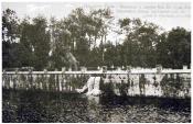
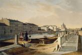
The Taytsi gravity conduit, designed by the engineer F.B. Bauer, dams along Sadovaya Embankment, designed by the engineer I. Gerard, were built, the water facilities system of parks was improved and the many hydraulic constructions - bridges
|
|
|
Source: Tsarskoe Selo
|
|
hidden
|
1774-1778
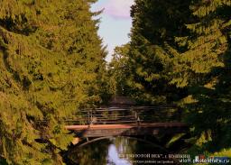
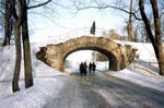
The system of the Great Cascade ponds with dams was constructed to the design by Colonel-Engineer I.
|
|
|
Source: Tsarskoe Selo
|
|
hidden
|
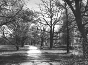
Babolovsky Park (Pushkin town)
BABOLOVSKY PARK (Pushkin town), a monument of landscape architecture situated in the southwestern part of Pushkin town is a part of Tsarskoe Selo palace park ensemble. Its area consists of 268,8 hectares
|
|
|
|
|
hidden
|
Bridges (entry)
BRIDGES, an integral part of the urban planning structure and architectural appearance of St. Petersburg. In 2002, the city numbered 342 bridges of various kinds and types; in Kronstadt: 5 bridges, Pushkin: 54 bridges, Petrodvorets: 51 bridges
|
|
|
|
|
hidden
|
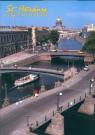
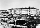
Embankments (entry)
EMBANKMENTS, engineering works built along the waterways of St. Petersburg from the early 18th century in order to stabilise banks and reclaim land. The first wooden embankments appeared in Gorodskoy Island on the left bank of the Neva River between
|
|
|
|
|
hidden
|
Gerhard, Ivan Kondratyevich ( Johann - Konrad) (1720–1808), an engineer, privy councillor.
Gerhard, Ivan Kondratyevich ( Johann - Konrad) (1720–1808), an engineer, privy councillor. He was born in Germany (Schwabia) and he got the elementary education there after that he learned at the Academy of Sciences in St Petersburg
|
|
|
|
|
hidden
|
Kalinkin Bridges
KALINKIN BRIDGES (Kalinkinsky Bridges), three bridges in the surroundings of a Finnish village Kalyola or Kallina (in the Russian manner Kalinkina), which existed in the 17th-19th centuries in the lower reaches of the Fontanka River
|
|
|
|
|
hidden
|
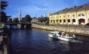
Kryukov Canal
KRYUKOV CANAL runs from the Admiralty Canal by Truda Square to the Fontanka River. 1015 meters long, it was dug from the Neva River to the Moika River in 1719-20 and was named after the contractor Semen Kyukov in 1738 (the section from the Neva to
|
|
|
|
|
hidden
|
Landings, Water (entry)
LANDINGS, WATER. Ship landings were present in St. Petersburg from the first years of its existence. Their location depended on the location and orientation of storage warehouses
|
|
|
|
|
hidden
|
New Holland
NEW HOLLAND (103 Moika River Embankment), a complex of storage facilities situated on the cognominal island (with an area of approximately 3 hectares), appearing in 1720 after the laying out of the Admiralty and Kryukov canals of the Moika River
|
|
|
|
|
hidden
|
Obvodny Canal
OBVODNY CANAL flows from the Neva River in the area of Alexander Nevsky Lavra to the Ekaterinhofka River (8.08 km long, 21.3 meters wide and 42.6 meters wide in its eastern part)
|
|
|
|
|
hidden
|
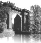
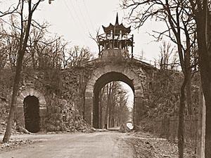
The Great Caprice
The Great and Little Caprice were built in 1772–1774 by the architect V.I. Neyelov and the engineer I. Gerard over the road led to the Great Tsarskoye Selo Palace. The road was named “Under Caprice road”. There are many legends concerning caprices
|
|
|
Source: Tsarskoe Selo
|
|
hidden
|
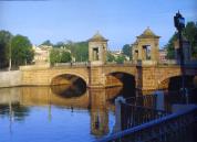
The Red (Turkish) Cascade (an ensemble of the Catherine Palace)
The sign of the cascade is two round narrowed upwards Gothic towers with red brick facades. Lancet windows, narrow slit-embrasures, merlon parapets give to the cascade the appearance of the fortress construction
|
|
|
Source: Tsarskoe Selo
|
|
hidden
|
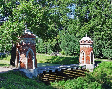
The Small Caprice (an ensemble of the Catherine Park)
The Small Caprice like the Great Caprice has the decorative and utilitarian function, it connects the Catherine and Alexander parks. Such kinds of constructions were necessary for constructing a convenient way from a part of the Tsarskoye Selo Park
|
|
|
Source: Tsarskoe Selo
|
|
hidden
|
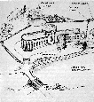
The Taitsi water supply system
The Taitsi water supply system (TW) was the water supply system of Tsarskoye Selo built according to the order of Catherine II in 1772-1787 in exchange for the outweared Vittelevo water supply system. The military engineer F.V
|
|
|
|
|