
|
|
|
|
Entries
/
Kurortny District
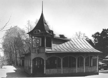
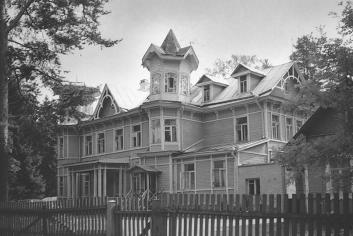
Kurortny DistrictReferences: Даринский А. В., Асеева И. В. География Санкт-Петербурга. СПб., 1996; Памятники истории и культуры Санкт-Петербурга, состоящие под государственной охраной: Справ. СПб., 2000; Атлас исторического наследия Санкт-Петербурга. СПб., 2001; Историческая застройка Санкт-Петербурга: Перечень вновь выявленных объектов, представляющих ист., науч., худож. или иную культур. ценность (учетных зданий): Справ. СПб., 2001. Е. А. Bondarchuk, P.Y. Yudin. Persons
Petrov Nikolay Nikolaevich
Repin Ilya Efimovich Addresses
Primorskoe Freeway/Sestroretsk, town
Svobody Square/Sestroretsk, town, house 1 Bibliographies
Даринский А. В., Асеева И. В. География Санкт-Петербурга. СПб., 1996
Памятники истории и культуры Санкт-Петербурга, состоящие под государственной охраной: Справ. СПб., 2000 Атлас исторического наследия Санкт-Петербурга. СПб., 2001 Историческая застройка Санкт-Петербурга: Перечень вновь выявленных объектов, представляющих ист., науч., худож. или иную культур. ценность (учетных зданий): Справ. СПб., 2001 The subject Index
Finlyandsky Railway Station
Petrov Institute of Oncology Sestroretsk Instrumentation Plant Penaty, Museum Estate Komorovskoe Cemetery |


|
|


