Authors
/
hidden
|
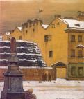
Kosmonavtov Avenue
KOSMONAVTOV AVENUE is located between Kuznetsovskaya Street and Svirskaya Street, running across the Alexandrovskaya Settlement and Srednyaya Rogatka. Laid out in the 1960s and named in honour of Soviet cosmonauts
|
|
|
|
|
hidden
|
Kosygina Avenue
KOSYGINA AVENUE (in 1976-82 Ladozhsky Avenue), located between the junction of the Oktyabrskaya Railway Line and Kommuny Street. It was built in the 1970s as an extension of Zanevsky Avenue, and named after A.N. Kosygin
|
|
|
|
|
hidden
|
Krasnoarmeiskie Streets, First - Thirteenth
KRASNOARMEISKAYA STREETS, FIRST - THIRTEENTH (until 1923, the First - Twelfth Roty, and Zarotnaya Street). First - Seventh Krasnoarmeiskaya Streets are located between Moskovsky Avenue and Izmailovsky Avenue; Eighth Krasnoarmeiskaya Street
|
|
|
|
|
hidden
|
Krasnogo Kursanta Street
KRASNOGO KURSANTA STREET (until 1923, Bolshaya Spasskaya Street), located between Bolshoy Avenue of the Petrogradskaya Side and Novoladozhskaya Street. Appeared in the 1720s, in what was then the Nevsky Garrison Regiment settlement (until 1727
|
|
|
|
|
hidden
|
Krasnoputilovskaya Street
KRASNOPUTILOVSKAYA STREET, running from Komsomolskaya Square to Pobedy Square, passing through the Avtovo area, the former Vologodskaya-Yamskaya Settlement, the Alexandrovskaya Settlement, and Srednaya Rogatka
|
|
|
|
|
hidden
|
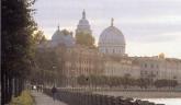
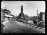
Kronverkskaya Embankment
KRONVERKSKAYA EMBANKMENT is located between Troitskaya Square and Kronverksky Avenue along the right bank of Kronverksky Strait. It was laid in 1980 and received its name after Kronverk at the same time
|
|
|
|
|
hidden
|
Kronverksky Avenue
KRONVERKSKY AVENUE, between Troitskaya Square and Mytninskaya Embankment, on the Petrogradskaya Side; its semicircular arch includes the territory of Alexandrovsky Park. The avenue was constructed in the first half of the 18th century
|
|
|
|
|
hidden
|
Kutuzova Embankment
KUTUZOVA EMBANKMENT, located on the left bank of the Neva River, running from Liteiny Avenue to the Fontanka River Embankment. In the 18th - first half of the 19th centuries, it formed a part of the Dvortsovaya Embankment; from 1860
|
|
|
|
|
hidden
|
Kuybysheva Street
KUYBYSHEVA STREET (until 1918, Bolshaya Dvoryanskaya Street; until 1935, 1st Derevenskoy Bednoty Street), located between Troitskaya Square and Petrogradskaya Embankment, on the Petrogradskaya Side. The street was named after Soviet statesman V.V
|
|
|
|
|
hidden
|
Kuznechny Lane
KUZNECHNY LANE, connects Zagorodny Avenue and Vladimirskaya Square with Ligovsky Avenue. In the 1740s, this territory was settled by blacksmiths serving the court. In the 1760s, the Church of Our Lady of Vladimir was erected along the street
|
|
|
|
|
hidden
|
Lanskoe Freeway
LANSKOE FREEWAY (in 1830-1850s, known as Lanskoy Avenue and Road; in 1962-91, known as Smirnova Avenue), running between the Chernaya Rechka Embankment and Engelsa Avenue
|
|
|
|
|
hidden
|
Lenina Street
LENINA STREET, running between Sytninskaya Street and Levashovsky Avenue, on the Petrogradskaya Side. Known as Shirokaya Street until 1923. In 1956, it included the former Y. Kalinina Street (until 1923, Matveevskaya Street)
|
|
|
|
|
hidden
|
Leninsky Avenue
LENINSKY AVENUE, running between Doblesti Street and Moskovskaya Square, part of the Central Circular Highway. It connects Yugo-Zapad and Ulyanka settlement, and Dachny and Moskovsky Avenues. The avenue, named in 1977 after V.I
|
|
|
|
|
hidden
|
Lesnoy Avenue
LESNOY AVENUE, from Akademika Lebedeva Street to Institutsky Lane, joining the Finlyandsky Railway Station with the Lesnoy District. The street was laid in the 19th century; until 1913, the avenue
|
|
|
|
|
hidden
|
Lieutenant Schmidt Embankment
LIEUTENANT SCHMIDT EMBANKMENT (until 1887, the Bolshaya Neva Embankment; until 1918, the Nikolaevskaya Embankment), on the right bank of the Bolshaya Neva River, between Seventh Line and Twenty Third Line of Vasilievsky Island. Named after P.P
|
|
|
|
|
hidden
|
Ligovsky Avenue
IGOVSKY AVENUE, running between Nekrasova Street and Moskovsky Avenue. Known as Ligovskaya Street until 1956. Constructed along the Ligovsky Canal track (hence the name) starting in 1891
|
|
|
|
|
hidden
|
Lines of Vasilievsky Island (entry)
LINES Of VASILIEVSKY ISLAND, the historical name of a number of parallel streets that intersect Vasilievsky Island from the south to the north: First to Twenty-Ninth Lines, Birzhevaya Line, Kozhevennaya Line, Kosaya Line, Mendeleevskaya Line
|
|
|
|
|
hidden
|
Lomonosova Street
LOMONOSOVA STREET, from Griboedova Canal Embankment to "Five Corners". The street was constructed in the first third of the 18th century. Since 1739, the lot before the Fontanka River was called Chernyshev Lane (after the manor of Count I.G
|
|
|
|
|
hidden
|
Makarova Embankment
MAKAROVA EMBANKMENT (until 1887 - Malaya Neva River Embankment, until 1952 - Tuchkova Embankment), between Birzhevaya Square and Smolenka River Embankment, on Vasilievsky Island, on the left bank of the Malaya Neva. The embankment was named after S
|
|
|
|
|
hidden
|
Maly Avenue of Petrogradskaya Side
MALY AVENUE Of PETROGRADSKAYA SIDE [in the 1770s - Malaya Perspektiva, in 1941-91 - Shchorsa Avenue, after N.A. Shchors a participant of the Civil War (1895-1919)], from Zhdanovskaya Embankment to Shevchenko Square and Kamennoostrovsky Avenue
|
|
|
|
|
hidden
|
Maly Avenue of Vasilievsky Island
MALY AVENUE Of VASILIEVSKY ISLAND [in the 1730-70s - Third Prospektivaya Street, in the 1780-1800s - Malaya Prospektiva, in 1939-44 - Zheleznyakova Avenue, after the participant of October Revolution and Civil War A.G
|
|
|
|
|
hidden
|
Metallistov Avenue
METALLISTOV AVENUE, between Yakornaya Street and Laboratornaya Street, a large transport thoroughfare that goes through the Bolshaya Okhta River, Rubleviki and Polyustrovo, following the bend of the Neva River
|
|
|
|
|
hidden
|
Mikhaylovskaya Street
MIKHAYLOVSKAYA STREET (known as Lassalya Street from 1918 to 1940, then called Brodskogo Street until 1991), between Nevsky Prospect and Iskusstv Square. The street, laid in 1834 after the design plan conceived by architect C.I
|
|
|
|
|
hidden
|
Millionnaya Street
MILLIONNAYA STREET [until 1738 - German settlement, until the middle of the 18th century - Bolshaya Nemetskaya Street, in the 1740-1800s - Bolshaya Millionnaya Street, in 1918-91 - Khalturina Street, after worker-revolutionary S.N
|
|
|
|
|
hidden
|
Mitrofanyevskoe Freeway
MITROFANYEVSKOE FREEWAY (until the 1890s - Bolshaya Mitrofanyevskaya Road), between the square of Baltiisky Railway Station and Yaltinskaya Street, parallel to Varshavskaya Railway Line
|
|
|
|
|
hidden
|
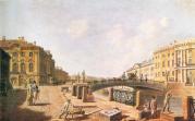
Moika, river
MOIKA (the original name Mya; known as Muya until the early 18th century, derived from the Izhora word for "slush, mire"), a river in the Neva river delta. The Moika River is 4.67 kilometres long, with a width of up to 40 metres
|
|
|
|
|
hidden
|
Monetnaya Bolshaya Street
MONETNAYA BOLSHAYA STREET, between Kronverkskaya Street and Chapaeva Street. In the second half of the 18th century it was Third Matveevskaya Street (after St. Matthew’s Church)
|
|
|
|
|
hidden
|
Morskaya Bolshaya Street
MORSKAYA BOLSHAYA STREET (in 1920-93 - Herzen Street, after A.I. Herzen), located from the General Staff Arch to Kryukov Canal. It was constructed in the early 18th century, in Morskaya settlement (hence the name)
|
|
|
|
|
hidden
|
Morskaya Embankment
MORSKAYA EMBANKMENT goes along the aggraded shore of the Gulf of Finland from the square in front of the Pribaltiyskaya Hotel to Nalichnaya Street (the name was given in 1972)
|
|
|
|
|
hidden
|
Morskaya Malaya Street
MORSKAYA MALAYA STREET (since 1738 - Bolshaya Lugovaya Street, since the middle of the 18th century until the 1820s - Novaya Isaakievskaya Street, in 1902-93 - Gogolya Street, after N.V. Gogol), between Nevsky Prospect and St. Isaac's Square
|
|
|
|
|