Authors
/
hidden
|
Prosveshcheniya Avenue
PROSVESHCHENIYA AVENUE, between Vyborgskoe Freeway and Rustaveli Street. It goes through First Pargolovo, Shuvalovo - Ozerki, Ruchyi, the main thoroughfare of an extensive area of newly-constructed buildings. The name has been in use since 1970
|
|
|
|
|
hidden
|
Pryazhka, river
PRYAZHKA, a river, flowing from the Moika River into Salnobuyansky Canal and on into the Neva River. The river is 1.32 kilometres long. Banny Bridge, Matisov Bridge and Berdov Bridge were span Pryazhka River
|
|
|
|
|
hidden
|
Pulkovskoe Freeway
PULKOVSKOE FREEWAY (until 1974, Kievskoe Freeway), from Pobedy Square to the city boundary, forms a continuation of Moskovsky Avenue, goes along the line of Pulkovsky meridian and closes on the dome of the Pulkovo Observatory
|
|
|
|
|
hidden
|
Pushkarskaya Bolshaya Street
PUSHKARSKAYA BOLSHAYA STREET (until 1798 - Malaya Ofitserskaya Street), between Syezzhinskaya Street and Kamennoostrovsky Avenue, on Petrogradskaya Side. The road appeared in the first third of the 18th century
|
|
|
|
|
hidden
|
Radishcheva Street
RADISHCHEVA STREET (until 1858 - Gospitalnaya Street, until 1935 - Preobrazhenskaya Street, renamed after A.N. Radishchev), between Zhukovskogo Street and Kirochnaya Street
|
|
|
|
|
hidden
|
Razyezzhaya Street
RAZYEZZHAYA STREET (in the first half of the 19th century, it was also referred to as Chernyshev Lane), between Zagorodny Avenue and Ligovsky Avenue. The road was named in 1739, constructed in the 1740s following the designs of St
|
|
|
|
|
hidden
|
Revolyutsii Freeway
REVOLYUTSII FREEWAY (until 1923 Porokhovskoe Freeway), between Piskarevsky Avenue and Kommuny Street. It was named after the October Revolution. The road was constructed in the first quarter of the 18th century as the road to the powder-mill (hence
|
|
|
|
|
hidden
|
Robespierre Embankment
ROBESPIERRE EMBANKMENT (in 1887-1916 Voskresenskaya Embankment, after the Holy Resurrection Church; until 1923 Belgiiskaya Embankment), on the left bank of the Neva River, between Smolnaya Embankment and Liteiny Avenue
|
|
|
|
|
hidden
|
Rubinsteina Street
RUBINSTEINA STREET (from 1739 - Golovin Lane, after house-owner Count F.A. Golovin; from 1798 - Troitsky Lane, after the Metochion of Holy Trinity Lavra of St. Sergius located at 44 Fontanka River Embankment, in 1887-1929 Troitskaya Street)
|
|
|
|
|
hidden
|
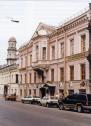
Sadovaya Street, Malaya
SADOVAYA STREET, MALAYA, between Italyanskaya Street and Nevsky Prospect (the shortest street of St. Petersburg, its length is 179 metres). It was built in the second half of the 18th century
|
|
|
|
|
hidden
|
Sampsonievsky Bolshoy Avenue
SAMPSONIEVSKY BOLSHOY AVENUE, named Samsonievskaya Street in 1739, then B. Samsonievsky Avenue in the early 19th century, receiving its present name in the late 19th century
|
|
|
|
|
hidden
|
Saperny Lane
SAPERNY LANE, between Mayakovskogo Street and Radishcheva Street. From the late 18th century, the road was known as Second Grafsky Lane, in the early 19th century - Kuznechny Lane
|
|
|
|
|
hidden
|
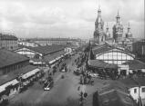
Sennaya Square
SENNAYA SQUARE (from 1952 to 1991 - Mira Square), located at the intersection of Sadovaya Street (some buildings numbered) and Moskovsky Avenue. The St. Petersburg Construction Commission proposed the construction of an extensive square on this site
|
|
|
|
|
hidden
|
Shkipersky Canal
SHKIPERSKY CANAL (Skippers' Canal) (before 1859, Chernaya Rechka (the Black River) or Glukhoy Protok (the Dead Canal), a small river in the western part of Vasilievsky Island
|
|
|
|
|
hidden
|
Shpalernaya Street
SHPALERNAYA STREET, from Gagarinskaya Street to Rastrelli Square. The street was known as First Line until 1727, then was called First Beregovaya Street. In the late 18th century it assumed the name Voskresenskaya Street or Voskresenskaya Embankment
|
|
|
|
|
hidden
|
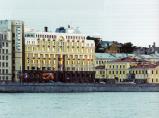
Sinopskaya Embankment
SINOPSKAYA EMBANKMENT, on the left bank of the Neva River, from Smolny Avenue to Alexandra Nevskogo Square. In the first half of the 18th century, it was called Naberezhnaya Street or Nevskaya Rozhdestvenskaya Embankment
|
|
|
|
|
hidden
|
Slavy Avenue
SLAVY AVENUE, between Vitebskaya Railway Line and Moskovskaya Railway Line. It was named in 1964 in honour of the military victories and feats of labour of Leningrad citizens
|
|
|
|
|
hidden
|
Smolenka, river
SMOLENKA, a river, which branches off the Malaya Neva from the left, below Tuchkov Bridge, and flows into the Neva Bay of the Gulf of Finland. The Smolenka separates Vasilievsky Island from Dekabristov Island. The river is 3.3 kilometres long
|
|
|
|
|
hidden
|
Smolnaya Embankment
SMOLNAYA EMBANKMENT, from Smolny Avenue to Robespierre Embankment. It received its name in 1887 after Smolny Cathedral (see Cathedral of the Renewal of the Jerusalem Holy Resurrection Temple)
|
|
|
|
|
hidden
|
Solyanoy Lane
SOLYANOY LANE, from Tchaikovskogo Street to Pestelya Street. In the first quarter of the 18th century, a canal was located here which enclosed the area of the Partikulyarnaya (Civil) Shipyard. In the 1730s St
|
|
|
|
|
hidden
|
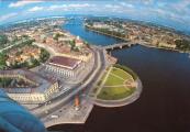
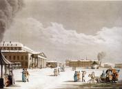
Spit of Vasilievsky Island
SPIT OF VASILIEVSKY ISLAND, a cape in the eastern part of Vasilievsky Island, washed by the Bolshaya Neva and Malaya Neva rivers, the highest part of the island and one of the main architectural ensembles of St. Petersburg. Built to architect D
|
|
|
|
|
hidden
|
Sredny Avenue of Vasilievsky Island
SREDNY AVENUE OF VASILIEVSKY ISLAND (called Malaya Pershpektiva from the 1730s until the 1770s, known as Mussorgskogo Avenue in 1939-44), from Makarova Embankment to Nalichnaya Street
|
|
|
|
|
hidden
|
Sverdlovskaya Embankment
SVERDLOVSKAYA EMBANKMENT (in 1887-1925 - Polyustrovskaya Embankment, after the area of Polyustrovo), on the right bank of the Neva River, between Arsenalnaya Street and Krasnogvardeiskaya Square. It was named after Y.M. Sverdlov
|
|
|
|
|
hidden
|
Svetlanovsky Avenue
SVETLANOVSKY AVENUE, between Svetlanovskaya Square and Suzdalsky Avenue. The avenue was built in the first half of the 20th century. In the 1910s, the lot between modern Toreza Avenue and Jacques Duclos Street was constructed and given the name
|
|
|
|
|
hidden
|
Teatralnaya Square
TEATRALNAYA SQUARE, known as Karuselnaya Square until the 1780s, surrounded by Griboedova Canal Embankment, Kryukov Canal Embankment, Dekabristov Street, Glinki Street and Soyuza Pechatnikov Street. The square was built in the 1760s
|
|
|
|
|
hidden
|
Tikhoretsky Avenue
TIKHORETSKY AVENUE, called Benua Avenue from 1909 to 1952, from Gidrotekhnikov Street to Severny Avenue. The avenue was laid in the early 20th century within the limits of Sosnovka and named after architect Y.Y
|
|
|
|
|
hidden
|
Toponymy of St. Petersburg
TOPONYMY OF ST. PETERSBURG, a corpus of names of geographical points situated on the territory of St. Petersburg. Names of rivers, islands, and villages located on the city's future territory appeared long before its foundation
|
|
|
|
|
hidden
|
Toreza Avenue
TOREZA AVENUE, called Staro-Pargolovsky Avenue until 1964, from Muzhestva Square to the intersection of Engelsa Avenue and Severny Avenue. The avenue was laid in the 18th century and led towards Pargolovo (hence the original name)
|
|
|
|
|
hidden
|
Tri Iskusstva (The Three Arts), journal
TRI ISKUSSTVA (The Three Arts), a non-commercial journal for architects, artists and designers published from 1998, produced with a frequency of one to two issues per year
|
|
|
|
|
hidden
|
Troitskaya Square
TROITSKAYA SQUARE, called Kommuny Square from 1918 to 1923, then known as Revolyutsii Square until 1991, between Kamennoostrovsky Avenue and Kuybysheva Street. The square appeared in the early 18th century on Gorodskoy (present-day Petrogradsky)
|
|
|
|
|