hidden
|
Admiralteysky Islands
ADMIRALTEYSKY ISLANDS, two islands, first and second, situated in the centre of St. Petersburg between the Bolshaya Nevka River and the Moika River. The first Admiralteysky Island is between Lebyazhy Canal and Winter Canal and Second Admiralteysky
|
|
|
|
|
hidden
|
Aptekarsky Island
APTEKARSKY ISLAND, (Apothecary Island), situated in the estuary of the Neva River between the Karpovka River separating it from Petrogradsky Island, Malaya Nevka River, and Bolshaya Nevka River. It is 198 hectares in area, 2.7 kilometres long and 1
|
|
|
|
|
hidden
|
Bely Island
BELY ISLAND, artificial island at the mouth of the Bolshaya Neva River. It was built by reclaiming the so-called Bely Shoal in the mid-20th century. It is 55 hectares in area, one kilometre long, and 600 metres wide
|
|
|
|
|
hidden
|
Berezovy Island
BEREZOVY ISLAND, 1) named Petrogradsky Island until the early 18th century, which is accurately translated from the Finnish name of Koivusaari. 2) From 1799, the name Berezovy Island was transferred to the small island about one hectare in area
|
|
|
|
|
hidden
|
Bezymyanny Island
BEZYMYANNY ISLAND, large territory over 16 square kilometres in area situated in the centre of St. Petersburg between the Neva, Monastyrka River, Obvodny Canal, Fontanka River, and Ekaterinhofka River
|
|
|
|
|
hidden
|
Buyans (entry)
BUYANS, is the common name of the small, often artificial, islands that were used to accommodate warehouses for various goods easily transportable by water between the 18th and the early 20th century
|
|
|
|
|
hidden
|
Bychy Island
BYCHY ISLAND situated between the Bolshaya Nevka River, Srednaya Nevka River, and Grebnoy Canal. It is 14 hectares in area, 800 meters long and 200 metres wide
|
|
|
|
|
hidden
|
Dekabristov Island
DEKABRISTOV ISLAND (Island of Decembrists), known as Goloday Island until 1926 in the west of St. Petersburg. It is situated north of Vasilievsky Island and separated from it by the Smolenka River. It is 4
|
|
|
|
|
hidden
|
Duderhof Heights
DUDERHOF HEIGHTS a group of hills of glacial origin in the south of St. Petersburg eastwards from Krasnoe Selo and the Ligovo-Gatchina Railway. In the early 18th century they were known as the Duderhof Hills later Duderhof Heights (from Lappish
|
|
|
|
|
hidden
|
Earthern Dams
EARTHERN DAMS, zones within the territory of St. Petersburg with an artificially raised level. From the very first days of the city development bedding was used for the low spots to protect it from water, especially floods
|
|
|
|
|
hidden
|
Ekaterinhofsky Island
EKATERINHOFSKY ISLAND washed by the Ekaterinhofka River, Tarakanovka River, and Bumazhny Canal. It is 40 hectares in area and 700 metres long and wide. The island formed after Bumazhny Canal was built in the second half of the 18th century
|
|
|
|
|
|
hidden
|
hidden
|
Galerny Island
GALERNY ISLAND, (Galley Island), situated at the mouth of the Fontanka River about ten hectares in area. The island was extended to the north by narrowing the right branch of the Fontanka River in the late 18th century
|
|
|
|
|
hidden
|
Gorodskoy Island
GORODSKOY ISLAND, name of Petrogradsky Island in the first third of the 18th century. The first city buildings were constructed in the island near the present-day Troitskaya Square. Troitsky Island was another name used at that time.
Е. А
|
|
|
|
|
hidden
|
Gryazny Island
GRYAZNY ISLAND situated between the Olkhovka River and the Ekaterinhofka River, south of where the Tarakanovka River flows into the latter. The name dates back to 1838
|
|
|
|
|
hidden
|
Gutuevsky Island
GUTUEVSKY ISLAND situated at the mouth of the Bolshaya Neva River and washed by Morskoy Canal in the west and the Ekaterinhofka River in the east. It is 320 hectares in area, 3.8 kilometres long and 1.2 kilometres wide
|
|
|
|
|
hidden
|
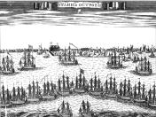
Islands (entry)
ISLANDS. A characteristic trait of St. Petersburg is its many islands, as it is located on the Neva River delta. There were 33 islands with official names in St
|
|
|
|
|
hidden
|
Izhora Hills
IZHORA HILLS (Izhora Plateau) the highest western part of the so-called Ordovician Plateau. It received its name form the Izhora people who inhabited the territory. It stretches between the Luga, Oredezh and Tosna River valleys approaching St
|
|
|
|
|
hidden
|
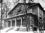
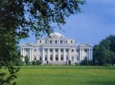
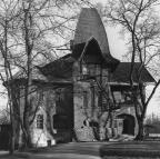
Kamenny Island, ensemble
KAMENNY ISLAND (in 1920-89 - Trudyashchikhsya Island), in the north-west part of the Neva river delta, located between the Bolshaya Nevka River to the north and the Malaya Nevka River to the south, the Krestovka River lies to the east
|
|
|
|
|
hidden
|
Kanonersky Island
KANONERSKY ISLAND situated in the southwest of the delta of the Neva River and separated from Gutuevsky Island by Morskoy Canal. In the west, it is bounded by the Gulf of Finland
|
|
|
|
|
hidden
|
Karelian Isthmus
KARELIAN ISTHMUS, a historic and geographical region between the Gulf of Finland and Ladoga Lake, in the south bounded by the Neva River, in the north - by a datum line linking Vyborg Bay of the Baltic Sea and Lekhmalakhti Bay north-westwards from
|
|
|
|
|
hidden
|
Kazansky Island
KAZANSKY ISLAND, an area in the centre of St. Petersburg between the Moika River, Griboedova Canal, and Kryukov Canal. The area is over 120 hectares. It was a part of Pervushin Island that also included Kolomensky Island, Pokrovsky Island
|
|
|
|
|
hidden
|
Kirovskie Islands
KIROVSKIE ISLANDS, the official name of Elagin Island, Krestovsky Island, and Kamenny (Stone) Island in 1934-93, named in memory of S. M.
|
|
|
|
|
hidden
|
Kolomensky Island
KOLOMENSKY ISLAND, historical name of the area between the Moika River, Kryukov Canal, Griboedova Canal, Fontanka River, Bolshaya Neva River, and Pryazhka River. Its area is over 90 hectares
|
|
|
|
|
hidden
|
Koltushi Hills
KOLTUSHI HILLS, a height east of St. Petersburg within the boundaries of Neva Lowland. It is a group of kame hills with a height of 60.5 to 78.3 meters above the reclaimed swampy piedmonts at the elevation of 25-35 meters formed along the
|
|
|
|
|
hidden
|
Kotlin, Island
KOTLIN, is an island in the east of the Neva Bay, in the Gulf of Finland. It is 23 kilometres west of Vasilievsky Island, 12 kilometres southwest of Gorskaya, and six kilometres north of Lomonosov
|
|
|
|
|
hidden
|
Krestovsky Island
KRESTOVSKY ISLAND (Cross Island), situated between the Srednaya Nevka River separating it from Elagin Island, the Malaya Nevka River separating it from Petrovsky Island, Petrogradsky Island, Aptekarsky Island
|
|
|
|
|
hidden
|
Krivaya Damba
KRIVAYA DAMBA (Curved Dam) is an artificial island bent in its plan (hence the name). It appeared during the construction of the Commercial Sea Port of St. Petersburg in 1870s. It is about one kilometre long and a maximum of 100 metres wide
|
|
|
|
|
hidden
|
Leningrad Region
LENINGRAD REGION, a federal subject of the Russian Federation located in the North-Western Federal District. Formed 1 June 1927, it has existed with its present boundaries since 1945
|
|
|
|
|
hidden
|
Matisov Island
MATISOV ISLAND situated between the Bolshaya Neva River, Moika River, and Pryazhka River. It is 26 hectares in area, 700 metres long, and 500 metres wide. In the early 18th century, it was called Kalasaari translated as Sloping Island from Finnish
|
|
|
|
|