hidden
|
Goncharnaya Street
GONCHARNAYA STREET, from Vosstaniya Square to Poltavskaya Street. Known as Novaya Pershpektivnaya Road in the mid-18th century, assuming its present-day name in the 1780s after the potteries and potters' settlements that developed here
|
|
|
|
|
hidden
|
Gorelovo, locality
GORELOVO, an area in the south-west of St. Petersburg, along Tallinskoe Freeway, to the north of Krasnoe Selo. It was named after a village of the same name. In the 19th - early 20th centuries
|
|
|
|
|
hidden
|
Gorely Stream
GORELY, a stream that flows in the north-east of St. Petersburg, near Rzhevka, leading it to be called Rzhevka River on occasion. The stream is a tributary of the Lubya River which forms part of the to the Okhta river basin
|
|
|
|
|
hidden
|
Gorodskoy Island
GORODSKOY ISLAND, name of Petrogradsky Island in the first third of the 18th century. The first city buildings were constructed in the island near the present-day Troitskaya Square. Troitsky Island was another name used at that time.
Е. А
|
|
|
|
|
hidden
|
Gorokhovaya Street
GOROKHOVAYA STREET, runs from Admiralteysky Avenue to Zagorodny Avenue, crossing the Moika River (Krasny Bridge), Griboedova Canal (Kamenny Bridge) and the Fontanka River (Semenovsky Bridge)
|
|
|
|
|
hidden
|
Gorskaya
GORSKAYA, locality in the southern part of Sestroretsk, east of Primorskoe Freeway. The territory incorporates a railway station of the same name within the railway line linking St. Petersburg and Sestroretsk and a summer settlement
|
|
|
|
|
hidden
|
Grafsky Lane
GRAFSKY LANE, running from Fontanka River Embankment to Vladimirsky Avenue. Called Golovin Lane from 1739 to the late 18th century; in 1923 it assumed the name Proletarsky Lane, and, in 1964, was renamed Marii Ulyanovoy Street (in honour of M.I
|
|
|
|
|
hidden
|
Grazhdanka
GRAZHDANKA, an area to the north of St. Petersburg. Named after a German settlement (sometimes, referred to as Gorozhanka) that was formed in the second half of the 18th century on Staraya Murinskaya Road (the present-day site of Favorskogo Street)
|
|
|
|
|
hidden
|
Grazhdanskaya Street
GRAZHDANSKAYA STREET, running from Griboedova Canal to Voznesensky Avenue. In the 1730s, it was known as Third Perevedenskaya Street, and called Srednaya Meshchanskaya Street from 1739 to 1882, then called simply Meshchanskaya Street
|
|
|
|
|
hidden
|
Grazhdansky Avenue
GRAZHDANSKY AVENUE, running from Nepokorennykh Avenue to Suzdalsky Avenue. The avenue was named after the locality Grazhdanka. Originally called Road to Gorozhanka Village (name known since 1817)
|
|
|
|
|
hidden
|
Grebnoy Canal
GREBNOY CANAL (Rowing Canal) is located in the northern part of Krestovsky Island in Primorsky Victory Park at the place of the former Vinnovka River. In 1938, the Grebnoy Canal was projected to be 2 km in length and run from the head of the
|
|
|
|
|
hidden
|
Grechesky Avenue
GRECHESKY AVENUE, running from Second Sovetskaya Street to Vilensky Lane. The avenue was laid in the 1860s and assumed its name in 1871 after the Greek Church of St. Demetrius of Thessalonica
|
|
|
|
|
hidden
|
Griboyedova Canal
GRIBOYEDOVA CANAL (the Ekaterininsky Canal in 1767-1923) starts from the Moika River at the Field of Mars and flows into the Fontanka River at Malo-Kalinkin Bridge. It is 5 km long and 32 meters wide with water flow of 3.1 - 3.4 m3
|
|
|
|
|
hidden
|
Grivtsova Lane
GRIVTSOVA LANE, running from the Moyka River Embankment to Sennaya Square. Starting in 1739, the lane was known as Malaya Sarskaya Street. From the 1770s to 1871, the section extending to the Ekaterininsky Canal was called Konny Lane
|
|
|
|
|
hidden
|
Gryazny Island
GRYAZNY ISLAND situated between the Olkhovka River and the Ekaterinhofka River, south of where the Tarakanovka River flows into the latter. The name dates back to 1838
|
|
|
|
|
hidden
|
Gulf of Finland
GULF OF FINLAND is the eastern part of the Baltic Sea running deep inland. The northern coast of the Gulf of Finland belongs to Finland; its southern part relates to Estonia and north-western and south eastern coasts are located in Russia
|
|
|
|
|
hidden
|
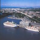
Gutuevsky Island
GUTUEVSKY ISLAND situated at the mouth of the Bolshaya Neva River and washed by Morskoy Canal in the west and the Ekaterinhofka River in the east. It is 320 hectares in area, 3.8 kilometres long and 1.2 kilometres wide
|
|
|
|
|
hidden
|
Gutuyevskaya Harbour
GUTUYEVSKAYA HARBOUR is an artificial rectangular Harbour (600x300 meters, 7 meters deep)located in the northern part of Gutuyev Island (hence the name). After its reconstruction during the building of the Morskoy Canal in 1874-75
|
|
|
|
|
hidden
|
Harbour
HARBOUR is an area in the western part of Vasilievsky Island. Soon after the foundation of St. Petersburg, earthworks and the artillery battery were put up here to protect the entrance to the Bolshaya Neva River
|
|
|
|
|
hidden
|
Hero-city Park
HERO-CITY PARK is situated in the south of St. Petersburg, between Pulkovskoe Highway, Moscovskoe Highway and Dunaysky Avenue. It was laid out on the site of orchards and vegetable gardens in 1972-80 and had an area of 25 hectares
|
|
|
|
|
hidden
|
Hydrographic network
HYDROGRAPHIC NETWORK. The hydrographic system of the precincts of St. Petersburg is formed by nearly 20,000 water flows, practically all of them pertaining to the Neva River basin. The total length of the currents exceeds 100,000 kilometres
|
|
|
|
|
hidden
|
Ingermanland
INGERMANLAND (Swedish variant, Ingermanland; Russian variant, Izhorskaya Zemlya, or Ingria), a historic-cultural region including the Neva region, the Gulf of Finland shore, and the southwestern of Ladoga Region
|
|
|
|
|
hidden
|
Internationalistov Park
INTERNATIONALISTOV PARK is situated in the south part of St. Petersburg, in Kupchino, between Slavy Avenue, Yuzhnoe Freeway, Bukharestskaya Street and Sofiiskaya Street
|
|
|
|
|
hidden
|
Inzhenernaya Street
INZHENERNAYA STREET, running from Griboedova Canal to Belinskogo Square. The street was named in 1823 after the Principal Engineering College, which was located in the Mikhaylovsky Castle
|
|
|
|
|
hidden
|
Irinovsky Avenue
IRINOVSKY AVENUE, running from Boksitogorskaya Street to Kommuny Street, one of the major arteries of the Porokhovye area. The avenue runs parallel to the former Irinovskaya Railroad line (hence the name)
|
|
|
|
|
hidden
|
Iskusstv Square
ISKUSSTV SQUARE, situated between Inzhenernaya Street and Italyanskaya Street. Known as Mikhaylovskaya Square from 1834 to 1918, then called Lassalya Square until 1940, in memory of German socialist F. Lassal (1825-64)
|
|
|
|
|
hidden
|
Islands (entry)
ISLANDS. A characteristic trait of St. Petersburg is its many islands, as it is located on the Neva River delta. There were 33 islands with official names in St
|
|
|
|
|
hidden
|
Italyanskaya Street
ITALYANSKAYA STREET, running from Griboedova Canal to the Fontanka River. Known as Bolshaya Italyanskaya Street from 1871 to 1919, then called Rakova Street until 1991
|
|
|
|
|
hidden
|
Ivanovka, river
IVANOVKA, a river in the south-west of St. Petersburg, in the area of Sosnovaya Polyana and Ligovo. It was named in the 19th century after the village of Ivanovskaya
|
|
|
|
|
hidden
|
Ivanovskaya Street
IVANOVSKAYA STREET, running from Obukhovskoy Oborony Avenue to the Moskovskaya Line of the Oktyabrskaya Railroad, part of the Central Arched Line. Named in the 1890s after a house-owner
|
|
|
|
|